• Home
  • Search
  • Browse Collections
  • My Account
  • About
  • DC Network Digital Commons Network™
Skip to main content
Department of Primary Industries and Regional Development, Western Australia
  • Home
  • About
  • My Account
Digital Library Digital Library
  1. Home
  2. >
  3. Maps & data
  4. >
  5. Natural Resources
  6. >
  7. Land Resource Publications Maps

Land Resource Publications Maps

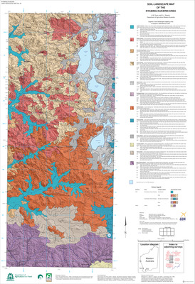
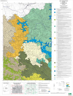
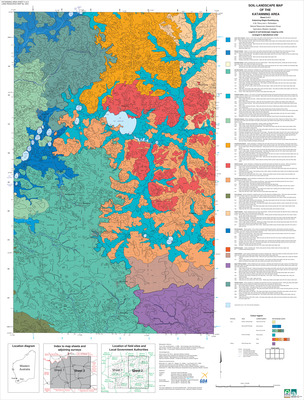
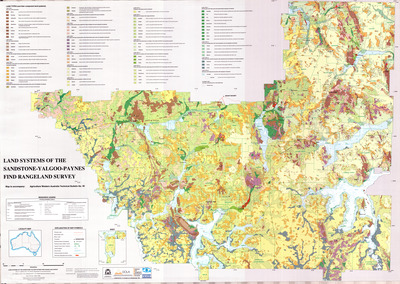
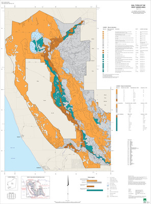
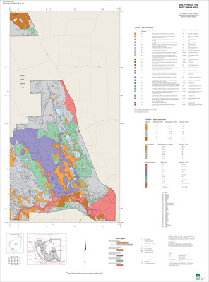
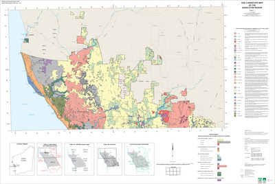
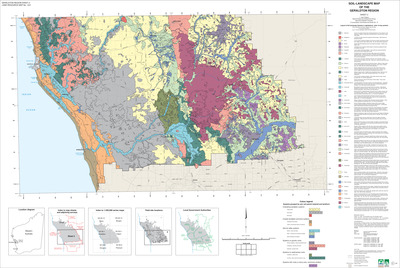
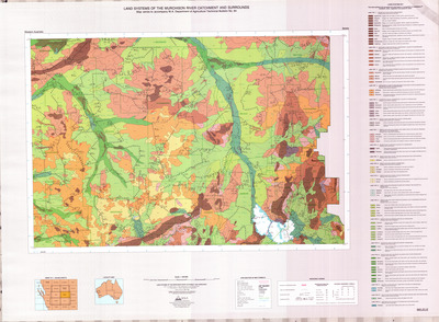
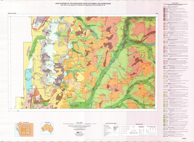
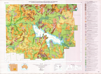
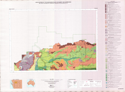
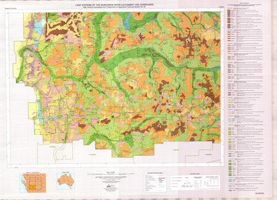
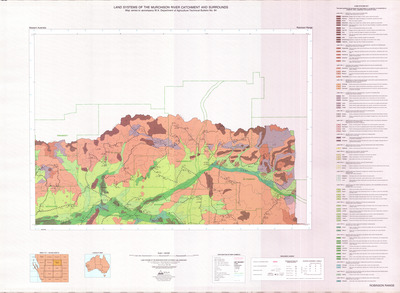
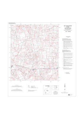
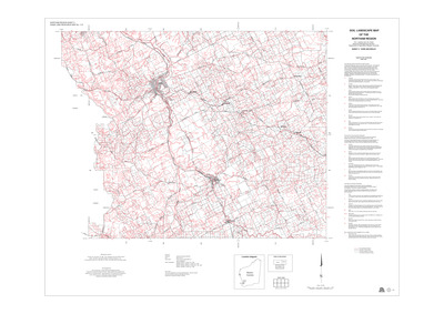
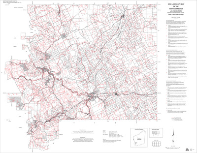
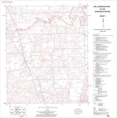
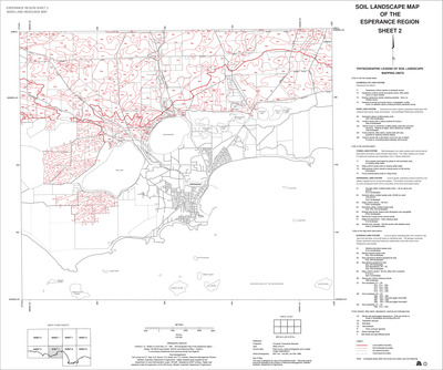
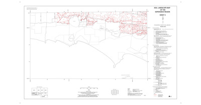
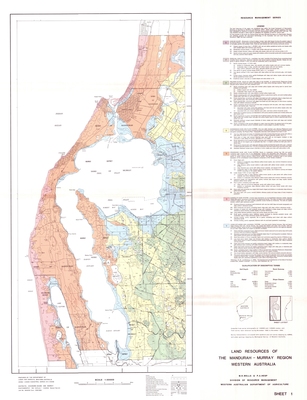
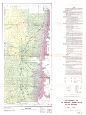
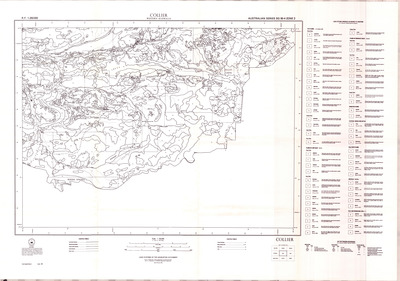
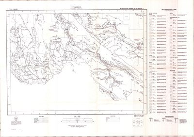
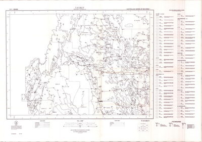
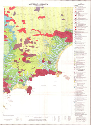
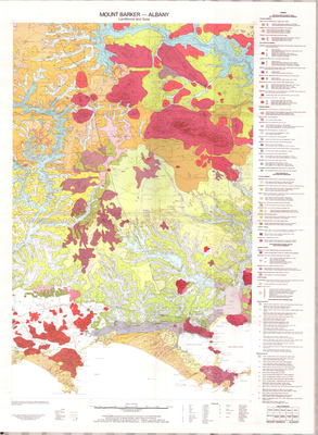
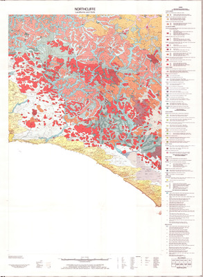
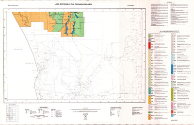
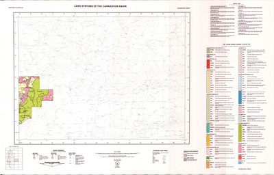
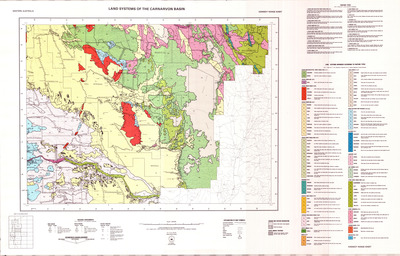
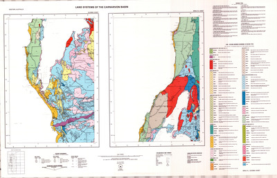
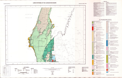
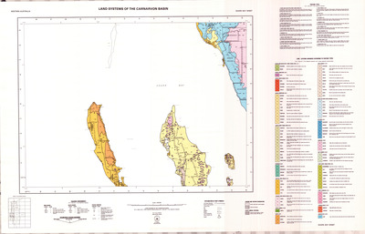
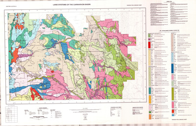
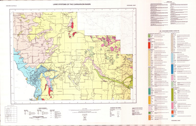
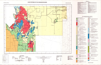
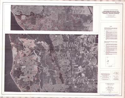
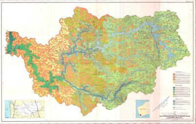
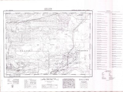
This collection contains maps that accompany the Technical Bulletin and Land Resources publication series and other notable soil and land maps

Printing is not supported at the primary Gallery Thumbnail page. Please first navigate to a specific Image before printing.

Follow

Switch View to List View Slideshow
 
  • Landforms and soils of the south coast and hinterland WA map – Mount Barker sheet by Department of Agriculture and Food, Western Australia

    Landforms and soils of the south coast and hinterland WA map – Mount Barker sheet

  • Landforms and soils of the south coast and hinterland WA map – Northcliffe sheet by Department of Agriculture and Food, Western Australia

    Landforms and soils of the south coast and hinterland WA map – Northcliffe sheet

  • An inventory and condition survey of rangelands in the Carnarvon Basin, Western Australia - map sheet Ajana by Department of Agriculture and Food, Western Australia

    An inventory and condition survey of rangelands in the Carnarvon Basin, Western Australia - map sheet Ajana

  • An inventory and condition survey of rangelands in the Carnarvon Basin, Western Australia - map sheet Edel by Department of Agriculture and Food, Western Australia

    An inventory and condition survey of rangelands in the Carnarvon Basin, Western Australia - map sheet Edel

  • An inventory and condition survey of rangelands in the Carnarvon Basin, Western Australia - map sheet Glenburgh by Department of Agriculture and Food, Western Australia

    An inventory and condition survey of rangelands in the Carnarvon Basin, Western Australia - map sheet Glenburgh

  • An inventory and condition survey of rangelands in the Carnarvon Basin, Western Australia - map sheet Kennedy Range by Department of Agriculture and Food, Western Australia

    An inventory and condition survey of rangelands in the Carnarvon Basin, Western Australia - map sheet Kennedy Range

  • An inventory and condition survey of rangelands in the Carnarvon Basin, Western Australia - map sheet Minilya and Quobba by Department of Agriculture and Food, Western Australia

    An inventory and condition survey of rangelands in the Carnarvon Basin, Western Australia - map sheet Minilya and Quobba

  • An inventory and condition survey of rangelands in the Carnarvon Basin, Western Australia - map sheet Ningaloo Yanrey by Department of Agriculture and Food, Western Australia

    An inventory and condition survey of rangelands in the Carnarvon Basin, Western Australia - map sheet Ningaloo Yanrey

  • An inventory and condition survey of rangelands in the Carnarvon Basin, Western Australia - map sheet Shark Bay by Department of Agriculture and Food, Western Australia

    An inventory and condition survey of rangelands in the Carnarvon Basin, Western Australia - map sheet Shark Bay

  • An inventory and condition survey of rangelands in the Carnarvon Basin, Western Australia - map sheet Winning Pool Edmund by Department of Agriculture and Food, Western Australia

    An inventory and condition survey of rangelands in the Carnarvon Basin, Western Australia - map sheet Winning Pool Edmund

  • An inventory and condition survey of rangelands in the Carnarvon Basin, Western Australia - map sheet Wooramel by Department of Agriculture and Food, Western Australia

    An inventory and condition survey of rangelands in the Carnarvon Basin, Western Australia - map sheet Wooramel

  • An inventory and condition survey of rangelands in the Carnarvon Basin, Western Australia - map sheet Yaringa-Byro by Department of Agriculture and Food, Western Australia

    An inventory and condition survey of rangelands in the Carnarvon Basin, Western Australia - map sheet Yaringa-Byro

  • Landforms and soils as an aid to urban planning in the Perth metropolitan north west corridor, Western Australia by Department of Agriculture and Food, Western Australia

    Landforms and soils as an aid to urban planning in the Perth metropolitan north west corridor, Western Australia

  • Landforms and soils of the Murray river catchment area Western Australia map by Department of Agriculture and Food, Western Australia

    Landforms and soils of the Murray river catchment area Western Australia map

  • Gascoyne Catchment pastoral land survey Collier map sheet by Department of Agriculture and Food, Western Australia

    Gascoyne Catchment pastoral land survey Collier map sheet

  • Gascoyne Catchment pastoral land survey Edmund map sheet by Department of Agriculture and Food, Western Australia

    Gascoyne Catchment pastoral land survey Edmund map sheet

  • Gascoyne Catchment pastoral land survey Glenburgh map sheet by Department of Agriculture and Food, Western Australia

    Gascoyne Catchment pastoral land survey Glenburgh map sheet

  • Gascoyne Catchment pastoral land survey Kennedy Range map sheet by Department of Agriculture and Food, Western Australia

    Gascoyne Catchment pastoral land survey Kennedy Range map sheet

  • Gascoyne Catchment pastoral land survey Mt Egerton map sheet by Department of Agriculture and Food, Western Australia

    Gascoyne Catchment pastoral land survey Mt Egerton map sheet

  • Gascoyne Catchment pastoral land survey Mt Philips map sheet by Department of Agriculture and Food, Western Australia

    Gascoyne Catchment pastoral land survey Mt Philips map sheet

 
  • 1
  • 2
  • 3
  • 4
  • 5
  • 6


Search

Advanced search
Help Using Search

  • Notify me via email or RSS

Browse

  • Collections
  • Disciplines
  • Authors

Author Corner

  • Submit content

Library Services

  • DPIRD website
  • Search DPIRD Library Catalogue

Gallery Locations

  • View gallery on map
  • View gallery in Google Earth

Follow Us

  • DPIRD Facebook
  • Fisheries Facebook
  • DPIRDBroadacre on X
  • DPIRD YouTube
  • Fisheries YouTube
  • DPIRD LinkedIn
 

DPIRD acknowledges the Traditional Custodians of Country, the Aboriginal people of the many lands that we work on and their language groups throughout Western Australia and recognise their continuing connection to the land and waters.

We respect their continuing culture and the contribution they make to the life of our regions and we pay our respects to their Elders past, present and emerging.

Artwork: "Kangaroos going to the Waterhole" by Willarra Barker.

Elsevier - Digital Commons

Home | About | My Account | Accessibility Statement

Privacy Copyright